察哈尔右翼前旗至丰镇公路设计(一)(含CAD图)
来源:wenku7.com 资料编号:WK719485 资料等级:★★★★★ %E8%B5%84%E6%96%99%E7%BC%96%E5%8F%B7%EF%BC%9AWK719485
以下是资料介绍,如需要完整的请充值下载。
1.无需注册登录,支付后按照提示操作即可获取该资料.
2.资料以网页介绍的为准,下载后不会有水印.资料仅供学习参考之用. 密 保 惠 帮助
资料介绍
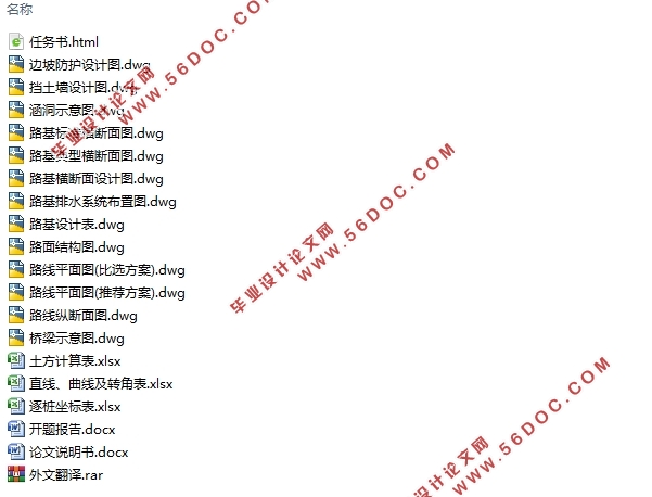
察哈尔右翼前旗至丰镇公路设计(一)(含CAD图)(任务书,开题报告,外文翻译,论文计算书13000字,CAD图纸13张)
摘 要
本设计为内蒙古察哈尔右翼前旗至丰镇公路D1标段的道路设计,起点为红梁西北部,终点为庄头窑子东部G208国道附近。设计说明书的各章节分别对道路设计的各个环节进行了较为详细的叙述,并且重点介绍了部分设计内容,基本反映出本人整个设计过程的思路和流程。
总体设计步骤可分为两部分,首先进行初步设计,根据任务书提供的资料确定道路的各项技术标准,运用纬地软件选择最优路线方案,再完成平纵横设计和桥涵位置的确定。
初步设计完成后,从拟定路线方案中选取具有代表性的1km路段进行详细设计。包括标准横断面设计、路基路面设计、排水系统设计和桥涵设计,并将挡土墙验算和路面结构验算作为重点。
关键词:公路;设计;技术标准;路基路面
Abstract
This design is the road design for the D1 section ofChahar Right Front Banner toFeng Town Highway in Inner Mongolia. The starting point is the northwestern part of Hongliang and the end point is near the g208national road in the south of Zhuangtou Kiln.Each chapter of the design specification provides a detailed description of each aspect of the road design, and highlights some of the design content, which basically reflects the ideas and processes of the entire design process.
The overall design steps can be divided into two parts. Firstly, the preliminary design is carriedout. According to the data provided in the task book, the technical standards of the road aredetermined. The optimal route plan is selected by using the weft software, and then the flatvertical and horizontal design and the position of the bridge and culvert are determined.
After the preliminary design is completed, a representative 1km section is selected from theproposed route plan for detailed design. Including standard cross-section design, subgradepavement design, drainage system design and bridge and culvert design, and the focus of theretaining wall check and pavement structure check.
Keywords:highway; design; technical standard; subgrade and pavement
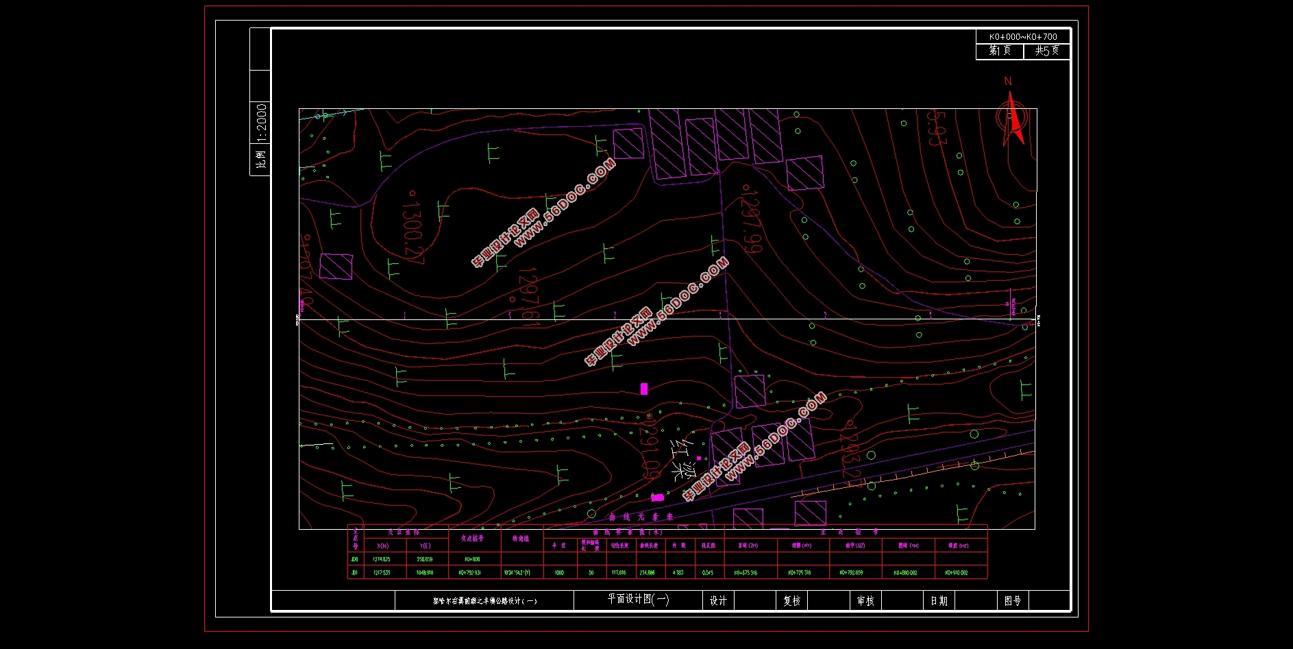
路线方案全长3377.587m,设计时速为60km/h,共设计3个交点,平曲线均采用基本形曲线,各项指标均满足规范。
目录
第1章绪论 1
1.1 概述 1
1.1.1 地理位置 1
1.1.2 地形地貌及植被 1
1.1.3 水文地质条件 1
1.2 建设理由 1
第2章道路类型、等级的确定和技术标准论证 3
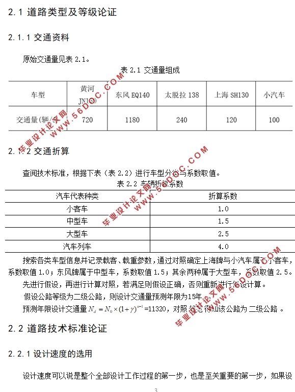
2.1 道路类型及等级论证 3
2.1.1 交通资料 3
2.1.2 交通折算 3
2.2 道路技术标准论证 3
2.2.1 设计速度的选用 3
2.2.2 平面线形标准论证 4
2.2.3 竖曲线要素标准论证 5
2.2.4 净空高度论证 6
2.2.5 车辆荷载论证 6
第3章路线设计 8
3.1 选线的步骤和方法 8
3.2 影响路线方案的主要因素 8
3.3 路线方案拟定 9
3.4 路线方案的比选 10
3.4.1 具体路段分析 10
3.4.2 总结 12
第4章路线平面、纵断面设计 14
4.1 平面设计 14
4.1.1 概述 14
4.1.2 平曲线设计计算 14
4.2 纵断面设计 16
4.2.1 纵断面设计的步骤方法 16
4.2.2 纵断面设计的一般要求 16
4.2.3 概述 16
4.2.4 竖曲线设计计算 16
4.3 线形组合设计 17
第5章路基、路面设计 18
5.1 一般路基设计 18
5.1.1 路基宽度 18
5.1.2 路基高度 18
5.1.3 路基边坡坡度 19
5.1.4 路基超高、加宽设计 19
5.1.5 路拱横坡设计 19
5.2 特殊路基设计 19
5.3 土石方数量计算与调配 19
5.4 路基支挡设计 20
5.4.1 挡土墙结构型式 20
5.4.2 挡土墙的基础 20
5.4.3 挡土墙验算 20
5.5 路基防护工程设计 25
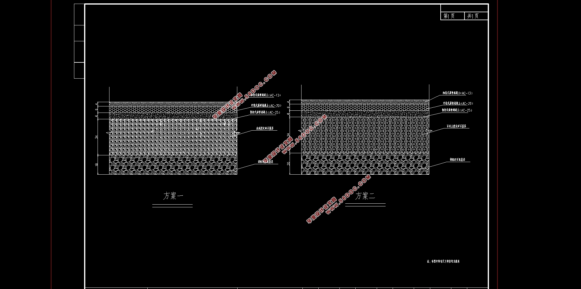
5.6 路面设计 26
5.6.1 概述及资料 26
5.6.2 路面参数选取 26
5.6.3 拟定路面方案 30
5.6.4 设计材料参数 32
5.6.5 路面结构验算 32
5.6.6 方案比选 38
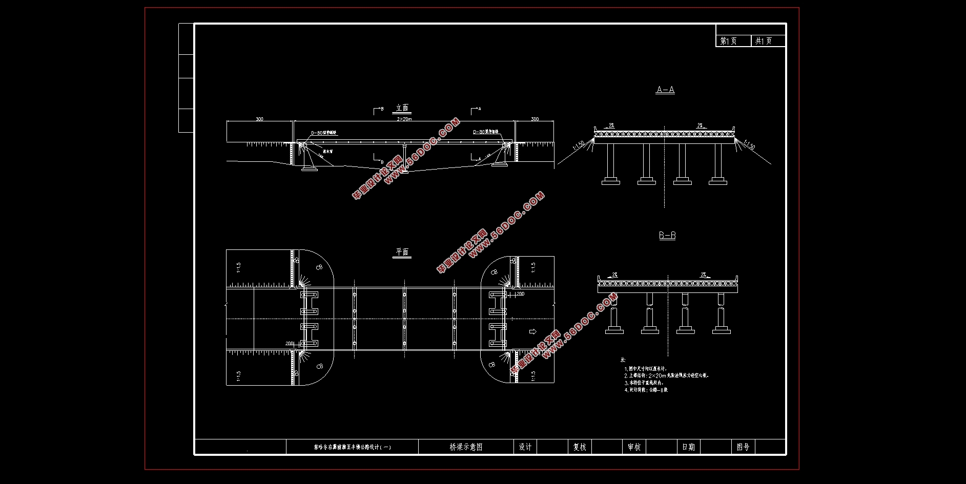
第6章桥涵及排水设计 39
6.1 中(小)桥设计 39
6.2 涵洞设计 39
6.2.1 确定涵洞的位置及结构类型 39
6.2.2 涵洞设计原则 39
6.3 路基排水设计 40
6.4 路面排水设计 41
参考文献 42
致谢 44
|